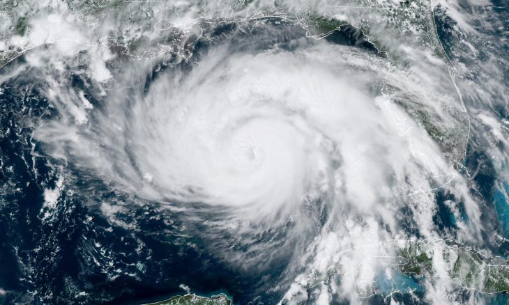
Louisiana braces for landfall that could be devastating
Hurricane Ida continues to gather strength and become better organized as it moves northwesterly toward the Louisiana coast. Landfall is expected anywhere between Sunday afternoon to late evening.
Gulf water temperatures are above 85 degrees which favors rapid strengthening of the storm. Severe warnings have been issued for many regions and it would appear that it will make landfall in a direct hit on New Orleans—on the anniversary of Hurricane Katrina. At landfall, Ida will likely be stronger than Katrina which was a Category 3 storm.
Winds are expected to exceed 140 miles per hour and will be accompanied by heavy rain and storm surges Flooding is expected.
Coastline communities from north Texas to the Florida Panhandle will be impacted. Evacuations are encouraged.
The storm is forecast to move across Louisiana and Mississippi into North Alabama on Tuesday. By Wednesday, Ida will be weakening as the center of circulation moves toward the Tennessee valley.
As the Lord Leads, Pray with Us…
- For guidance for state and local leaders as they address the preparation of the storm making landfall
- For protection for the people of Lousiana, Texas, Mississippi, Alabama, Tennessee, and Florida as they are in the path of the storm.
- For God to redirect the path of the storm away from the coast.
Sources: CBS News, National Hurricane Center, Washington Post


